Research
Habitat, sediment, and limiting-factor assessments for watershed councils and agencies. Fieldwork, sampling, and analysis follow the agreed scope when needed.
- Habitat assessments
- Sediment and shade
- Limiting factors
Demeter Design · Watershed planning
Habitat and resource research and planning for community-based organizations.
Quote-only. We reply with scope and timeline.
What we do
Watershed councils, agencies, and community groups bring a question. We study it, rank the options, and write the plan.
Habitat, sediment, and limiting-factor assessments for watershed councils and agencies. Fieldwork, sampling, and analysis follow the agreed scope when needed.
Ranks restoration reaches using habitat data, surveys, GIS, and existing reports, so the work starts where it matters most.
Supporting method: GIS and mapping. Drinking-water and housing overlays, passage, and habitat maps that explain the resource visually.
The action plan is the written packet after the research: the plan a council can fund, with restoration priorities for the work plan.
Completed projects
Published assessments, with the maps that explain the resource. Open a map to see the full sheet.
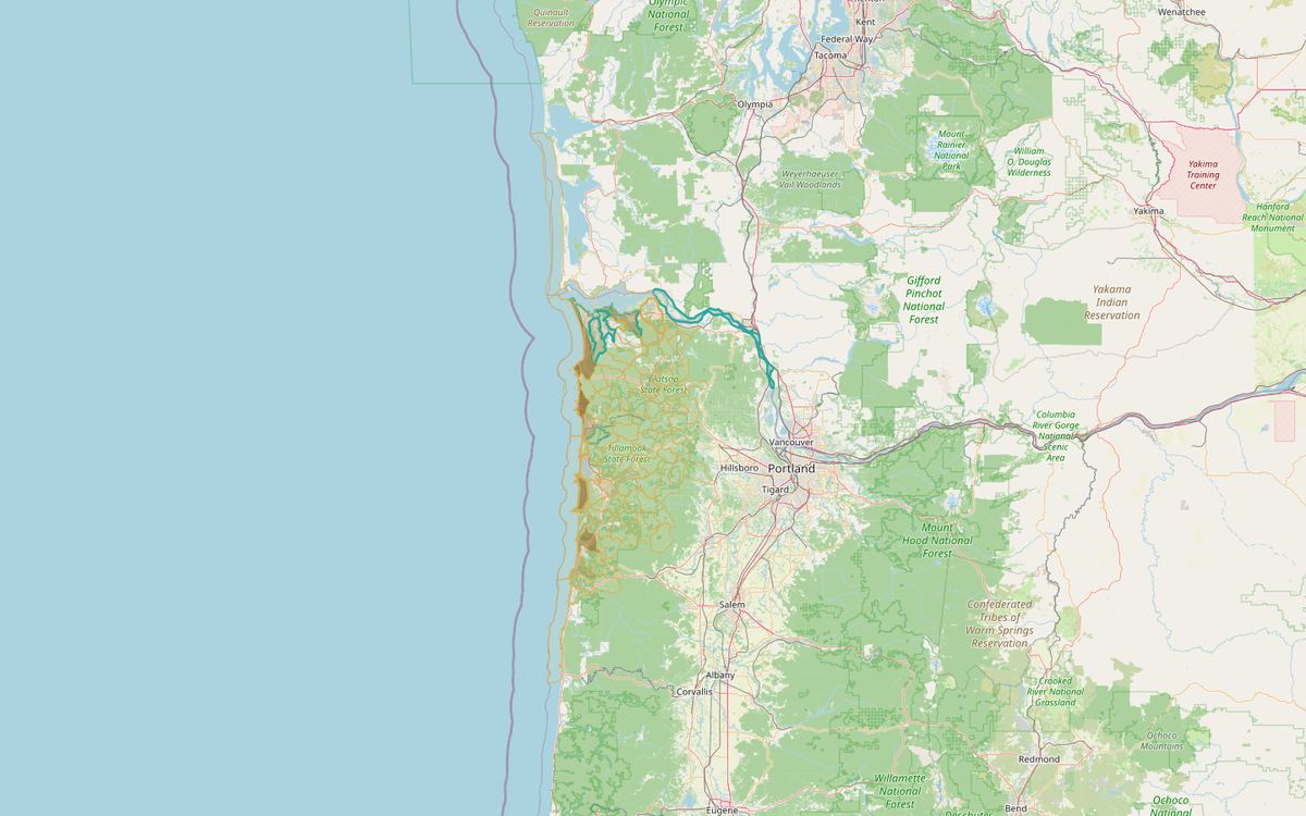
Drinking-water source mapping across Clatsop and Tillamook creeks.
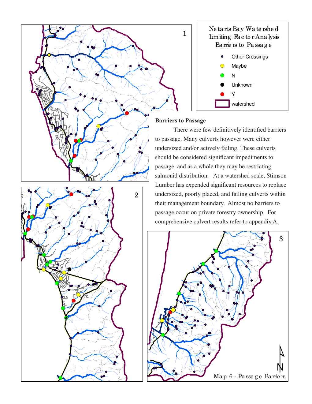
Undersized and failing culverts limit coho, steelhead, and chum in Netarts Bay. Prepared in 2008 for the Tillamook Estuaries Partnership.
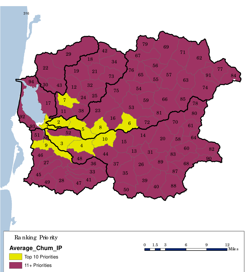
Ranked restoration-habitat map for the Tillamook Bay work plan. Top 10 priorities are marked in yellow. 2008, Tillamook Bay Watershed Council.
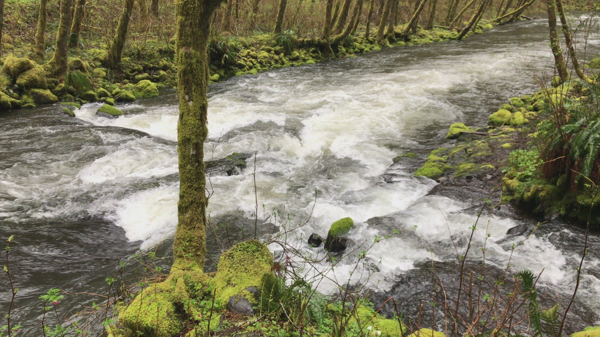
Field check of OWEB riparian planting and fencing. Most surveyed projects were gone or failing. Maintained sites did best.
Also on file: North Fork John Day, a 2010 habitat and sediment assessment on Forest Service and Bureau land, prepared for the Bureau of Land Management. The report is not hosted here yet.
Research library
Cara’s published watershed papers for Nestucca, Siuslaw, Netarts, and other Oregon Coast basins. Download the PDF when we have it; otherwise open Academia.
Request a quote
Ask for research, analysis, or a plan. We reply with scope and timeline. Fieldwork follows the agreed scope when needed.